
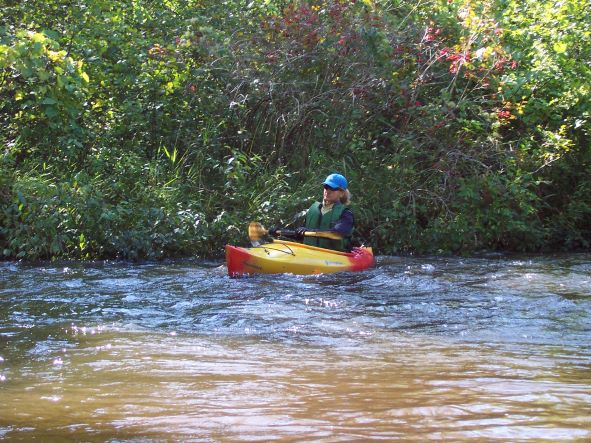
Highlights: This river has the distinction of being one of two rivers on which I broke a paddle (I always carry a spare now). Making a quick turn in the fast current, I was grabbed by tree limbs hanging over the river. I managed to remain upright, but half of my paddle decided to stay in the tree as I continued downstream. Needless to say, I never underestimated the Betsie again. Served by a couple of liveries, Betsie is mostly well-maintained, but early-season paddling, when the Bestie is at her liveliest, can test a paddler with swift water as the river flows through quintessential northern Michigan woodlands and meadows.
Distance: Bike: About 6 miles. Paddle: About 7 miles.
Difficulty: Biking: Easy on mostly flat to gently rolling paved and dirt roads. Kayaking: At least basic maneuvering skills. The river twists and turns, and when it’s running fast, it’s easy to get sucked under an overhanging tree or caught in deadfall.
Location: Driving east on Wallin Road, turn right (south) onto dirt Long Road. Continue straight, and after about .25-mile, when the river comes close to the road, turn left onto a two-track (if you reach Meadow Lane, you’ve gone too far). Leave your boats at this rustic access site. Return to Wallin and turn left. Turn left again at Carmean Road then right onto King Road. Take a left onto Thompsonville Road (County Road 689). Turn right onto dirt Gallagher (on some maps spelled as Gallegar) Road and continue to the Betsie River Day-Use Park and Nature Trail. Park here or continue across the bridge and park at one of two pull-outs. Look for a short, sandy trail on the west side of the bridge; this is the takeout.
(Car shuttle: Using the directions above, park one car at the takeout and then drive the second car to the put-in.)
Route finding: Biking: Retrace the route you drove. Kayaking: An old train trestle (now part of the Betsie Valley Trail) alerts paddlers that the takeout is close (at the next bridge). Expect to scrape and/or get stuck on the riverbed due to low water during much of the summer. It’s possible to paddle the river during these months by looking for deeper water along the river edges (usually on the outside banks), but it’s almost impossible not to get beached at least once.
Map: Find a PDF map here.
