Highlights: The unpredictable Ocqueoc River is always an adventure with new deadfall replacing last year’s and beaver dams coming and going; yet, its unpredictability also makes it one of my favorites. Located in sleepy Presque Isle County, this segment of the Ocqueoc rushes through a forested landscape, home to few cabins but an abundance of wildlife—owl sightings are common. Paddling here is a solitary experience, giving one a taste for what early Michigan explorers might have experienced.
Distance: Bike: About 4 miles on paved roads. (If you’re feeling energetic, pedal the 2.5 to 6.6-mile, dirt Ocqueoc Falls Pathway, which begins at the Falls’ parking area, almost opposite the campground.) Paddle: About 6.5 miles.
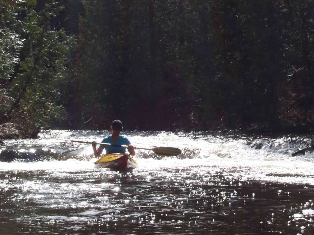
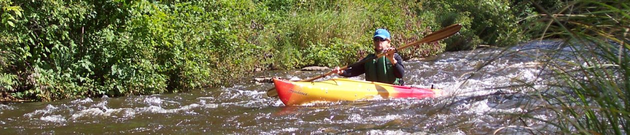
Difficulty: Biking: Easy if you simply retrace your tracks back to Millersburg; moderate if you ride the Pathway. Kayaking: This paddle can be quite challenging from deadfall and portaging to beaver dams and quick turns to rapids and low-hanging trees. The Chipmunk Falls, a four-foot drop, comes up about 2 miles before the takeout. It’s a fun rush when the water is high but expect to get swamped or at the very least extremely wet (consider scouting the falls before attempting them and portage if necessary). A lamprey net is often placed near the base of the Chipmunk Falls and will require portaging.

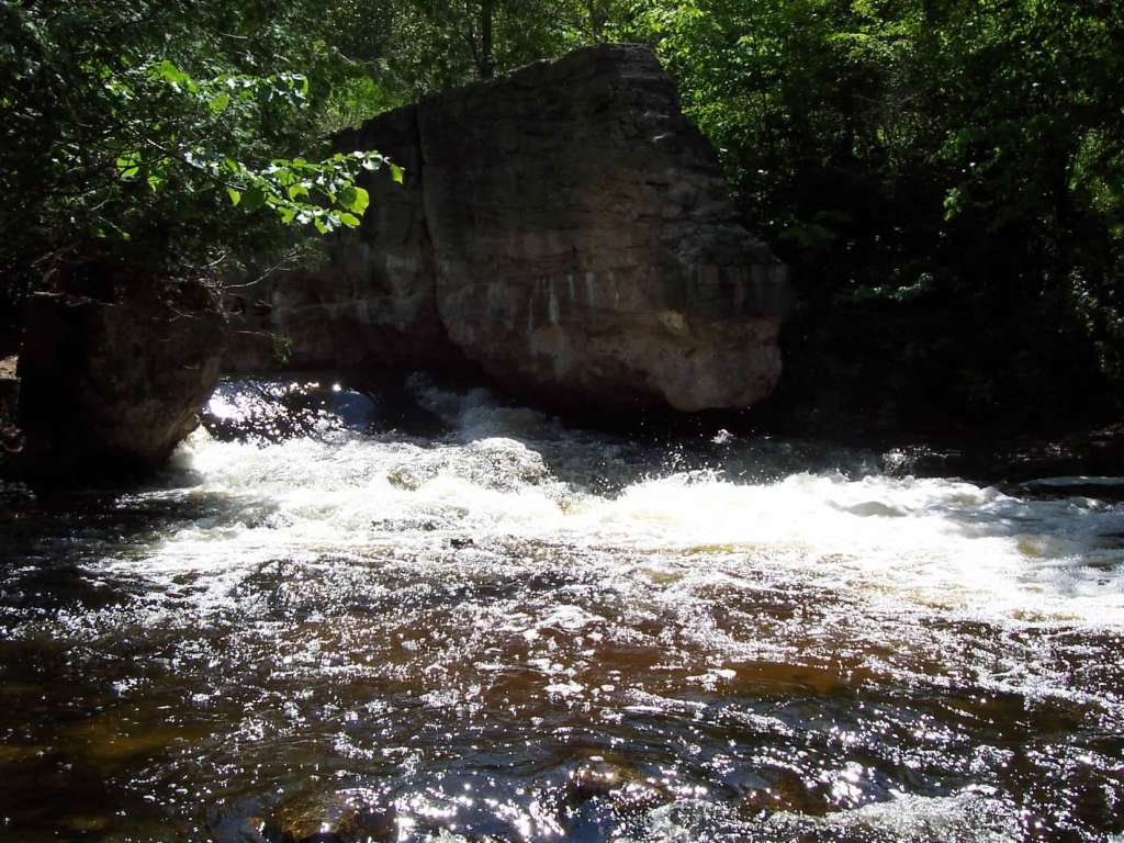
Location: Leave kayaks at the small riverside park in Millersburg on Millersburg Road/Main Street, just north of the bridge that crosses the Ocqueoc River. Then drive north on Millersburg Road and turn right (east) onto M-68. Drive for about 2 miles and park at the picnic area on the left. This takeout area can be awkward due to the steep bank, so an alternative is to park at the Ocqueoc Falls State Forest Campground, a little farther downstream or near the campground entrance (from M-68, turn left onto River Road and then right onto Ocqueoc Falls Highway. The campground is just beyond the bridge). From here, kayakers can takeout at one of the sites bordering the river. Regardless of where you park, it’s vital that you can recognize the takeout from the river. The unpaddleable Ocqueoc Falls loom beyond the campground (below the bridge) with a succession of rocky descents and fast water. Be sure to check out the Falls before you bike back to the boats.
(Car shuttle: Using the directions above, park one car at the takeout and then drive the second car to the put-in.)
Route finding: Biking: Pedal back to the boats, the same way you drove. (Another option: to avoid cycling on M-68, take the Ocqueoc Falls Highway and S Ocqueoc Road to Walker Highway and back into Millersburg.) If you cycle the Pathway, it’s marked with numbered post and maps, making it hard to get lost. Kayaking: This section of the Ocqueoc is only paddleable during spring runoff or after heavy rain, and without a livery maintaining it, the Ocqueoc changes from year to year (but it’s consistently demanding).
Websites and maps: Click here for a PDF map and here for maps and information from the DNR.