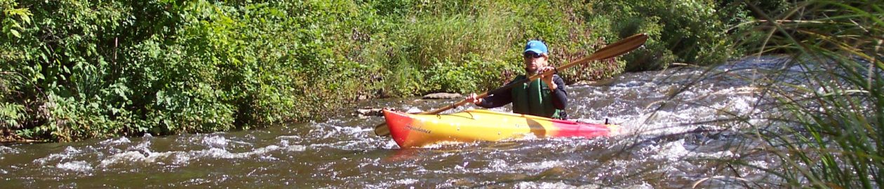

Highlights: The Maple River surprises paddlers every year with new deadfall to portage, logs to avoid, and branches to duck. Although there is occasional evidence of maintenance, the Maple is mostly left to its own devices, and it offers kayakers a rugged experience, particularly the difficult option (see below). Here, the water runs faster with more portaging, quick turns, and chances of tipping in. After about a mile, you enter an old flooding area, where the Lake Kathleen Dam was removed in 2018. The riffles continue, but the chances of portaging lessen. A series of short rapids take you under the Woodland Road bridge and into the easier portion of the paddle, where you float past the Hidden River Golf & Casting Club and start to see more homes. Even here, though, kayakers must stay alert.
Distance: Bike: For difficult/longer paddle: About 6 miles. Easier/shorter paddle: About 5 miles. Paddle: Difficult: About 8 miles. Easier: About 6.5 miles.

Difficulty: Biking: Both biking routes are mostly flat to gently rolling on paved roads and the crushed-limestone North Western State Trail (NWST). Kayaking: For both options, paddlers must be comfortable with quick turns, portaging, negotiating around debris/deadfall, ducking under branches, or paddling over sunken logs. Although the difficult option is only about 1.5 miles longer than the easier route, it requires more portaging and the ability to paddle through rapids while maneuvering around logs or other debris.
Location: For the difficult option, leave kayaks at the access site about 7 miles north of Alanson on M-31 on the left. For the easier option, drive M-31 about 6 miles north of Alanson. Turn west onto Woodland Road and continue about a quarter-mile to the bridge crossing the Maple River. Leave kayaks here. For both the difficult and easier option, backtrack a few miles on M-31and turn west onto Brutus Road. Continue for about 3 miles and turn right onto an unsigned two-track (about a quarter-mile after Brill Road). Drive to the end of the two-track, where you’ll find two gates. Park here. The gate on the right leads to the takeout on the Maple River. It’s a good idea to check it out before biking back to your kayaks as it isn’t signed and might be easy to miss while paddling.
(Car shuttle: Using the directions above, park one car at the takeout and then drive the second car to the put-in.)

Route finding: Biking: Difficult: Cycle back to Brutus Road and turn left, retracing your drive. Cross over M-31 and turn right onto the NWST. Continue cycling to your kayaks. Easier: Same as above but turn west onto Woodland Road after about 2.5 miles on the NWST. Kayaking: The river is fairly narrow so the route is usually obvious, except during high water when the river can spill out into the forest, creating new channels. Near the takeout, after crossing under the Brutus Road bridge, the river begins to branch out and it’s very important to stay left in order to not miss the take out.
Maps and websites: PDF map is here, and for more information about the NWST, click here.
