
Highlights: Although the Manistee River is a popular paddle, this section usually offers a solitary jaunt past a landscape that seems barely touched by the 21st century. Homes are scattered here and there, but for the most part, views include lush fields, hardwood forests, and the occasional angler. Adding to the charm, three creeks spill into the river, their silvery water gliding through dark forest, and close to North Sharon Bridge, the current quickens with a few actual rapids.
Distance: Bike: About 6 miles Paddle: About 9 miles.
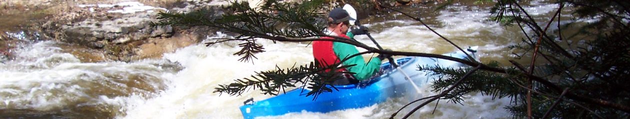
Difficulty: Biking: Mostly easy on paved and sandy roads with only a few hills; however, we always ride our fat-tire bikes because the sand can be deep in places. Kayaking: Maintained by liveries, this section of the Manistee increases in speed as you paddle downstream, from gentle to moderately fast with a few lively ripples.

Location: Leave kayaks at the CCC Bridge State Forest Campground and Access Site on Sunset Trail , about 18 miles southeast of Kalkaska. To find the takeout on West Sharon Road, drive south on Sunset Trail and turn right onto King Road. Stay on King for a few miles as it merges into Military Road. Take a right onto West Sharon Road. Continue on the paved road as it passes North Sharon Road and take a right on Thayer. The access site parking will be on the right; however, the actual takeout is at the bottom of the hill. Be sure to check it out before cycling back to your boats.
(Car shuttle: Using the directions above, park one car at the takeout and then drive the second car to the put-in.)
Route finding: Biking: Nothing should be confusing—the locations are easy to find on GPS and/or maps. Kayaking: The river splits around islands in several places. Either way is usually fine, but sometimes a channel might be clogged with deadfall. After the North Sharon Bridge, consider paddling right instead of left when the river splits (soon after the North Manistee merges from the right). The righthand channel offers a faster ride through a narrow stream with overhanging trees (sometimes, though, you’ll encounter a portage in this section).
Map: Find a PDF map here.

This is one of my family’s favorite summer kayaking trips. Next time we’ll try a bicycle shuttle.
LikeLiked by 1 person
Glad to hear that other people like this stretch of the river. Let me know how the bike shuttle goes.
LikeLike