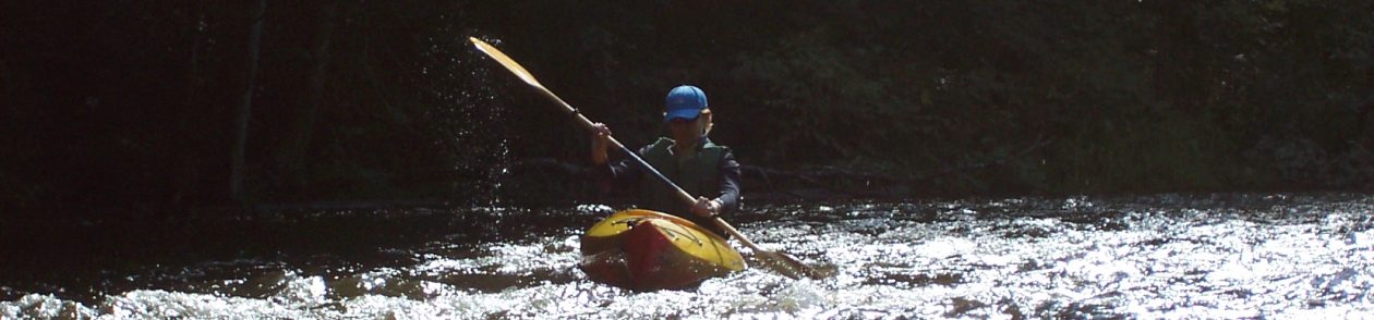

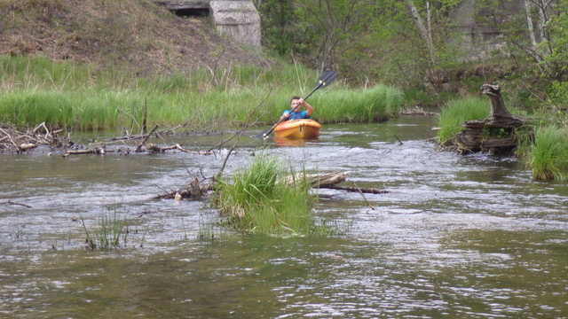
Highlights: This family-friendly paddle flows along a narrow portion of the Upper Au Sable River, passing quaint cottages and luxurious homes and sweeping over a few fast riffles. Geese often nest along the route and other birds, from redwing blackbirds to osprey, make their home on the river. One or two shallow areas might force kayakers out of their boats, and deadfall occasionally poses a problem. But almost all ages should find the trip a satisfying mini-adventure, making it an excellent introduction to biyaking for children. Afterward, reward yourself with a meal at one of many delicious restaurants in downtown Grayling.
Distance: Bike: About 4 miles Paddle: About 5-6 miles
Difficulty: Both the paddle and pedal are easy—a good outing for children.
Location: From downtown Grayling, head west on M-72 and turn north onto South Au Sable Trail. Continue until the road dead-ends at the Au Sable River and Pollack Bridge Road. Leave your kayaks at the bend of the river. Drive back to M-72 and turn left, continuing into Grayling. At the stoplight, turn right onto Cedar Street. Just before the bridge crossing the Au Sable, turn right into a parking lot for the City Park, also home to the Farmer’s Market. The take-out, a small concrete landing, can be found here. Leave your vehicle and cycle back to kayaks (see below for biking directions).
(Car shuttle: Using the directions above, park one car at the takeout and then drive the second car to the put-in.)

Route finding: Biking: From the City Park, follow the bike path behind Spikes Keg of Nails and Lighthouse Title Group. Turn left onto Burton Ct. and follow it around the corner. Turn left onto Michigan Avenue, cross over the railroad tracks, and then take an immediate right in front of the Courthouse. Continue on the dirt road until it once again meets the bike path and turn left. Follow the path for about 1.5 miles and then turn right onto Ole Dam Road, crossing over M-72 at the light. Stay on Ole Dam Road until it dead-ends at Friar Tuck Ln. and turn right. Take an almost immediate left onto Little John Ave., which will turn into dirt Yorke Trail. Continue biking on Yorke Trail and then take a left onto Pollack Bridge Road. Cycle straight to your kayaks. Kayaking: It’s best to paddle this portion of the Au Sable when the river is fairly high, but expect deadfall and other debris regardless of the water level. Just before the Ole Dam Bridge, the river cascades into a pool for a fun, easy series of riffles and light rapids. The river slows considerably after it crosses under the M-72 Bridge and enters a pond for the final mile or so of the paddle. This section can be frustrating as you dodge submersed stumps, but it’s also an opportunity for watching birds, as well as golfers on the greens of the Grayling Golf Club.
Map: PDF map is available here.

Looking forward to taking the family on this one!
LikeLiked by 1 person
Have fun!
LikeLike
Nice to see kids kayaking on their own. And I agree that Grayling restaurants are excellent!
LikeLiked by 1 person
Have fun!
LikeLike